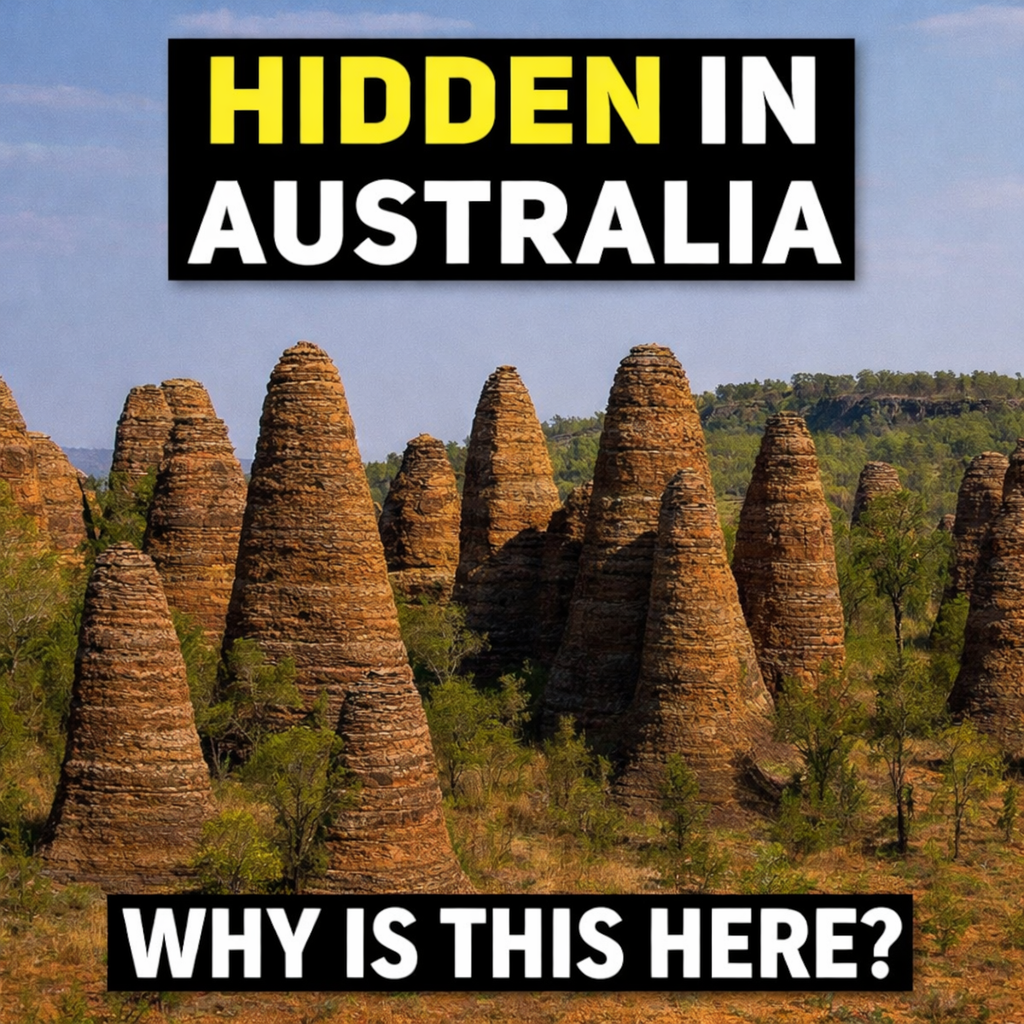
The Giant Oil Basin Hiding Beneath Australia
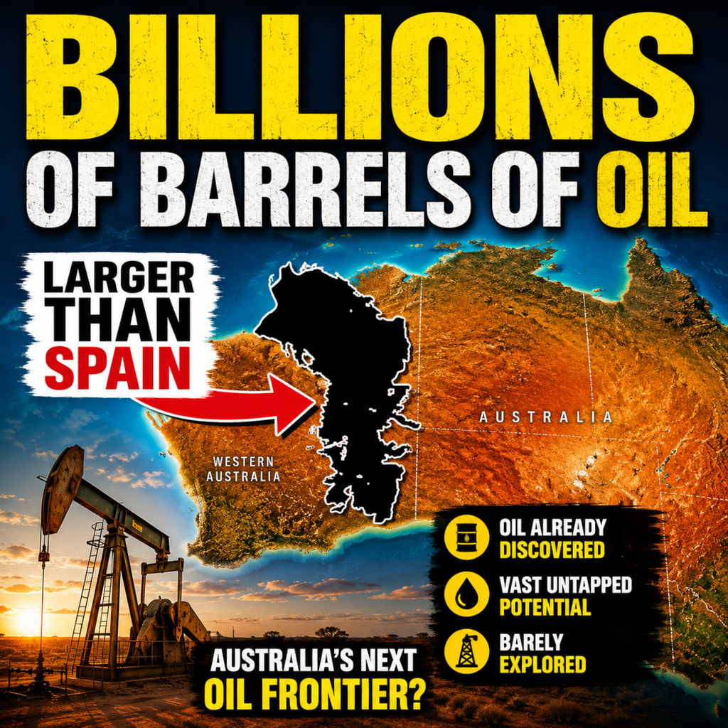
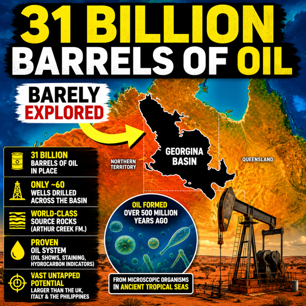
The Georgina Basin may be one of Australia's largest undiscovered petroleum provinces. Stretching across western Queensland and the Northern Territory, this enormous sedimentary basin covers more than 333,000 square kilometres and contains one of the richest source rocks ever identified in Australia. Unlike most petroleum systems, the hydrocarbons within the Georgina Basin originated from microscopic marine organisms that lived more than 500 million years ago, long before trees, dinosaurs, or even plants colonised the land. At the centre of the story is the Arthur Creek Formation, a source rock with total organic carbon values reaching an extraordinary 16 percent. Modern assessments suggest the basin may contain approximately 31 billion barrels of oil in place, yet only around sixty petroleum wells have ever been drilled across the entire region. With proven hydrocarbon generation, extensive reservoir potential, large structural traps, and vast areas remaining virtually unexplored, the Georgina Basin stands as one of Australia's greatest oil mysteries and a compelling target for future petroleum exploration.