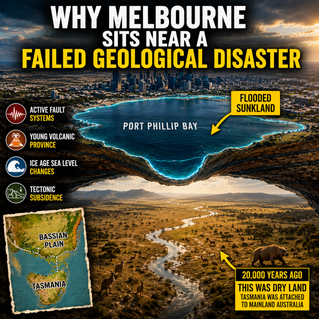
Why Melbourne Sits Near a Failed Geological Disaster
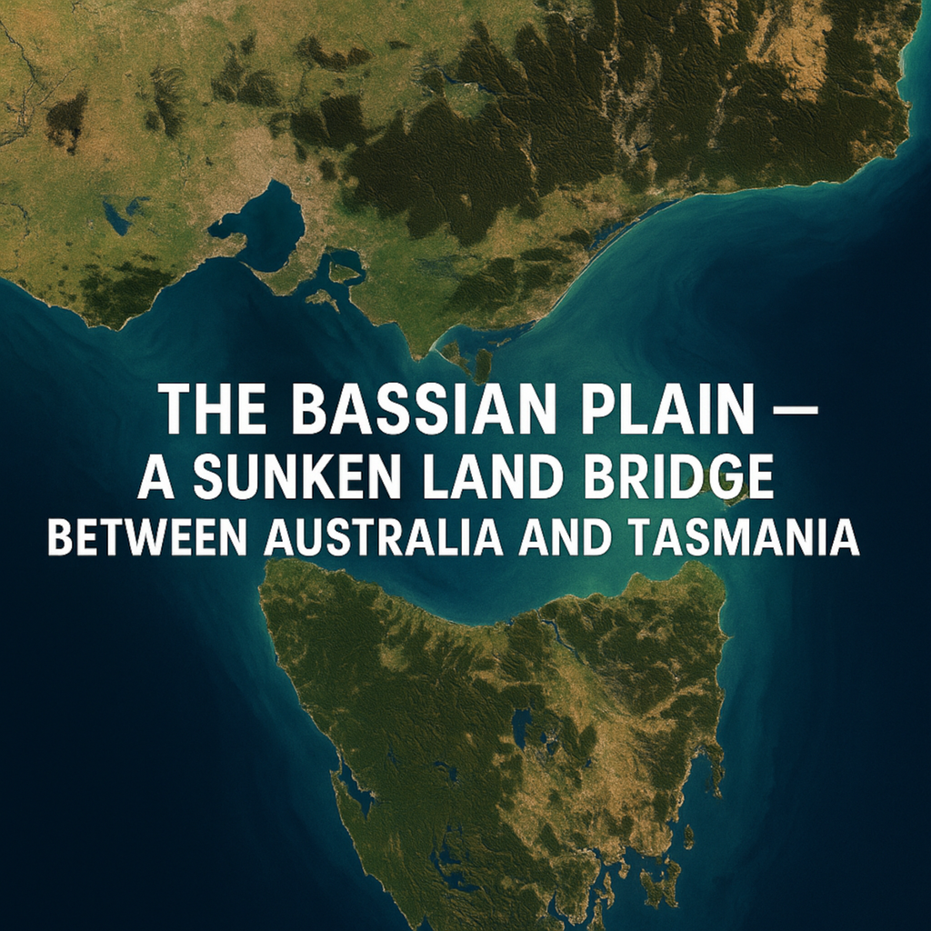
Melbourne looks stable, but the geology beneath Port Phillip Bay tells a far stranger story. In this Australian geology documentary, discover how tectonic faulting, the Port Phillip Sunkland, ancient earthquakes, volcanic eruptions from the Newer Volcanics Province, and dramatic ice age sea level changes helped create modern Melbourne. Travel back to a time when Bass Strait was dry land, Tasmania was connected to mainland Australia, and the Yarra River flowed across the lost Bassian Plain. This is the hidden geological history of Melbourne, Victoria, and one of Australia’s most extraordinary drowned landscapes.